 Source: U.S. Army Corps of Engineers
Georgia, Inland Waterways, National Category
Startup Uses Drone for Cleaning Water, Collecting Data


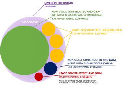
Seventeen million people across the nation live or work behind a levee. Levees protect critical infrastructure systems, $2.3 trillion of property, 4,500 schools that collectively enroll over 2 million students, and a range of industries. The National Levee Database contains nearly 30,000 miles of levees across the U.S., and current estimates identify up to 10,000 additional miles of levees outside of the U.S. Army Corps of Engineers (USACE) portfolio whose location and condition are unknown due to complex and varying local ownership. The USACE estimates that $21 billion is needed to improve and maintain the moderate to high-risk levees in its portfolio, which represents only about 15% of the known levees in the U.S. As more extreme weather events result in increased flooding, such as the $20 billion in damages caused by flooding in the Midwest during the spring of 2019, it is now more important than ever to have a complete inventory of the nation’s levees and to equip communities with tools and resources to mitigate flood risk and make necessary repairs.
Download Report
are, on average,
50 years old
of all levees, while the remaining 3% are
concrete, rock, and steel floodwalls.
safeguard
11 million people
Communities in all 50 states, the District of Columbia, Puerto Rico, and Guam depend on levees to mitigate flood risk. Earthen embankments make up 97% of all levees, while the remaining 3% are concrete, rock, and steel floodwalls. The nation’s levees are, on average, 50 years old, and many were built using engineering standards less rigorous than our current best practices.
Roughly 70% of the levees, or nearly 10,000 miles of levees, within the USACE’s portfolio are operated and maintained by a non-federal levee sponsor — i.e., a municipality or special district. The remaining levees in the portfolio — about 4,200 miles — are operated and maintained by the USACE. Of the levees operated by an entity other than the USACE, 55% are operated and maintained by a levee district or water management district, while 15% are operated and maintained by municipal or county governments. About 15% of all levee systems within the USACE’s levee portfolio have multiple levee sponsors responsible for operation and maintenance.
U.S. ACE Portfolio broken down by entity responsible for O&M and percentage of miles of the total portfolio
Source: USACE 2018 Levee Portfolio Report
In 2018, it was that $21 billion is needed to improve and maintain the moderate- , high- , and very high-risk levees in the USACE’s levee portfolio. This estimate does not include any of the levees outside of the USACE portfolio, so the actual cost to improve and maintain levees is unknown and is likely much higher. Federal funding for non-federally operated and maintained levees is limited, and most levee operation, maintenance, and repair is the responsibility of the levee owner.

Levees are vital components of public safety and help safeguard 11 million people, other critical infrastructure systems, and trillions of dollars of property. Over 9 million people — or 86% of the population living behind USACE levees — are concentrated behind about 150 levees, or just 7% of the total USACE levee portfolio.
LIDAR (Light Detection and Ranging) technology
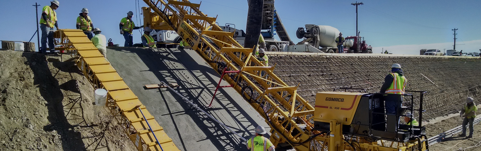
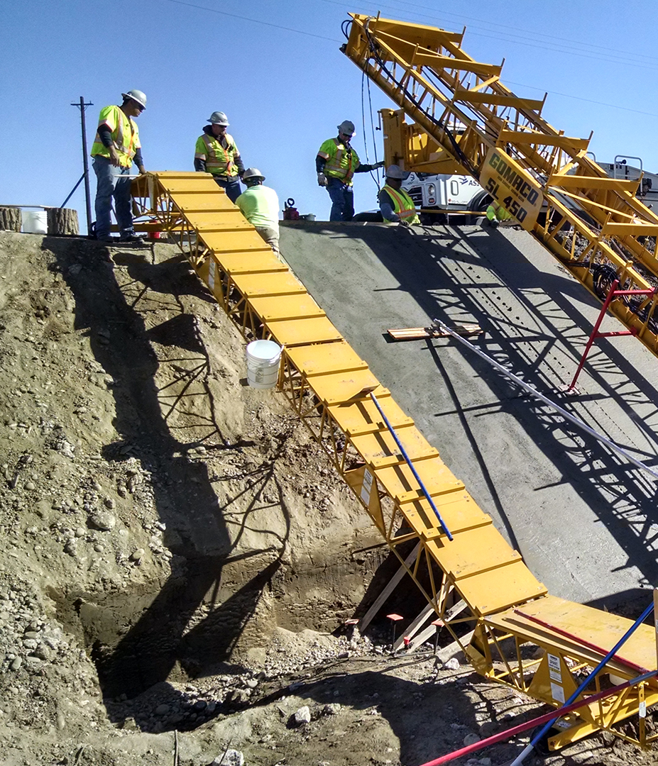
Several innovations have emerged in recent years to help maintain and modernize the nation’s levees. LIDAR (Light Detection and Ranging) technology is being tested and utilized to help identify levee maintenance issues, assess levee vulnerabilities, and efficiently and cost-effectively target improvements. This technology evaluates the risk of catastrophic levee failure and provides continuous and accurate assessments to mitigate risk. In other cases, drones are being used to fly over levees to collect pertinent data; this approach saves time and costs. Additionally, adding field-based sensing in new or existing levees to detect ground motion or seepage of water under levees is being considered to detect potential areas of concern before significant damage occurs.
Further, systems of “fuses” are being evaluated within levee systems that would operate and divert floodwater away from areas where there are high concentrations of people, property, and infrastructure. Much like fuses designed to protect electronic devices, levee fuses would be placed to “break” and redirect floodwater into lower-risk areas. While broken levee fuses would require post-flooding repair, the costs to repair the fuses are likely to be dramatically lower than the cost of restoring flood-damaged properties and infrastructure in areas of higher population.

Solutions that Work
Fully fund the National Levee Safety Program at $79 million a year to identify and inventory the location and condition of all the nation’s levees — federal and non-federal alike — and complete the National Levee Database.
Communities can work to reduce the number of new developments behind levees through zoning restrictions and land development regulations.
Increase resources, education, and outreach efforts to those communities that live and work behind levees in order to communicate to the public the risk to people, property, and critical infrastructure systems behind levees, as well as the risk and consequences of levee failure.
More broadly deploy and utilize innovative, efficient technologies, such as LIDAR, to quickly assess levees and identify problems.
When appropriate, encourage property owners behind levees to purchase flood insurance, even if behind an NFIP-accredited levee.
Increase the number of levees with an emergency action plan and flood warning plan.
Encourage states the authority to regulate levee safety.
Consider using risk-based design approach when designing new levees and evaluating existing levees.
U.S. Army Corps of Engineers, “U.S. Army Corps of Engineers Levee Portfolio Report: A Summary of Risks and Benefits Associated with the USACE Levee Portfolio,” March 2018.
Congressional Research Service, “Levee Safety and Risk: Status and Considerations,” December 7, 2017.
U.S. Army Corps of Engineers, “U.S. Army Corps of Engineers Levee Portfolio Report: A Summary of Risks and Benefits Associated with the USACE Levee Portfolio,” March 2018.
U.S. Army Corps of Engineers, “U.S. Army Corps of Engineers Levee Portfolio Report: A Summary of Risks and Benefits Associated with the USACE Levee Portfolio,” March 2018.
U.S. Army Corps of Engineers, “U.S. Army Corps of Engineers Levee Portfolio Report: A Summary of Risks and Benefits Associated with the USACE Levee Portfolio,” March 2018.
Congressional Research Service, “Levee Safety and Risk: Status and Considerations,” December 7, 2017.
U.S. Army Corps of Engineers, “U.S. Army Corps of Engineers Levee Portfolio Report: A Summary of Risks and Benefits Associated with the USACE Levee Portfolio,” March 2018.
Congressional Research Service, “Levee Safety and Risk: Status and Considerations,” December 7, 2017.
Federal Emergency Management Agency, Risk Mapping, Assessment and Planning (Risk MAP), https://www.fema.gov/risk-mapping-assessment-and-planning-risk-map.
Federal Emergency Management Agency Hazard Mitigation Assistance, https://www.fema.gov/hazard-mitigation-assistance.
U.S. Society on Dams “Monitoring Levees,” May 2016.
PHOTO ATTRIBUTES