Cycling in Pulau Ubin, Singapore http://tinyurl.com/pulauubin-cycle
Originally prepared in July 2008; updated 13th Jun 2021: Suggestions for leisurely bicycle rides on Pulau Ubin by Pedal Ubin Guides of NUS Toddycats
I – A Quick Fix
Preparation
Be careful and considerate on Pulau Ubin
| Bicycle rental is available left after leaving the jetty.
How to get there? Take the Ubin bumboat ferry ($4.00/person) from Changi Point Ferry Terminal To get to Changi Point Ferry Terminal:
Food and drinks on the island
|
II – Preparing for your cycling trip to Pulau Ubin
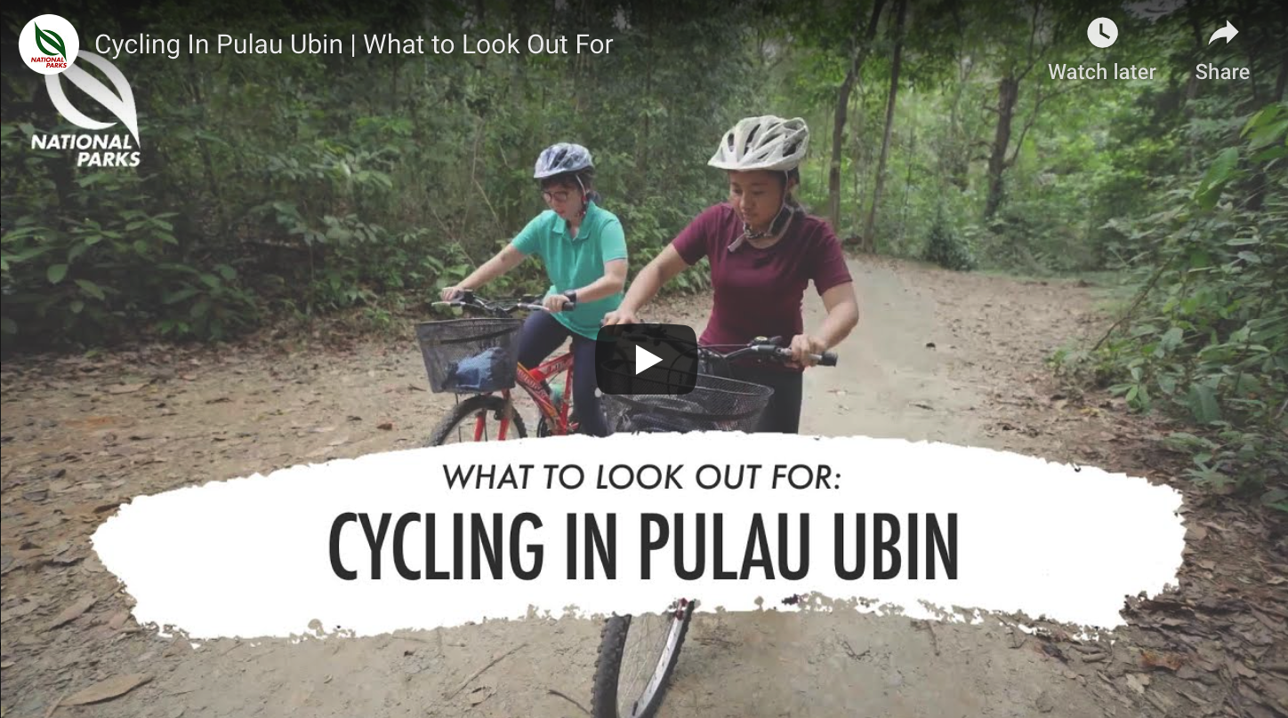
What to look out for when Cycling in Pulau Ubin (4mins)
What to see and do in Pulau Ubin?
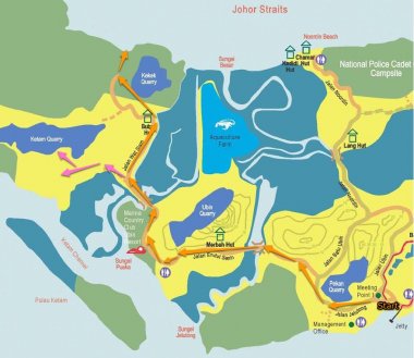
- First of all, orientate yourself with a map. Here is the link to the high-resolution 2015 NParks Map which you will see around the island.
- Enjoy a bicycle ride in relative safety - the roads are mostly paved, and there are also some wide unpaved trails mostly when you head towards Chek Jawa in the east. If you are a little skilled and adventurous, head for the Ketam Bike Park to try the Blue Square Trail.
- The water bodies north and south of Pulau Ubin (not the sea) are the Straits of Johor and Serangoon Harbour - you are always close to one or the other so the feel of a beach getaway is a charming feature of the island!
- Pulau Ubin has a nice mix of plants and animals due to multiple secondary forest recovering over ex-plantations and kampung grounds, interspersed with aquatic and inter-tidal habitats. Reforestation has been ongoing for two decades and more recently enhancement of aquatic habitats. To examine these in detail, get off your bike from time to time to look!
- The scenery of kampungs, plantations, forest, quarries and mangroves provides a feel of Singapore in the 1970’s, and it makes us feel nostalgic of our less urbanised past.
- Heritage on the island – there are clues to human presence and lifestyles on the islands, as well as shrines and temples which have persisted to this day and are frequented by devotees. Consult the 2015 NParks Map and watch some of the videos listed below,
- You may be able to buy seasonal fruits, with rambutans and durians (oooh!) being particular favourites – and coconuts are perennial!
- If you get the chance, talk to villagers who work and live there.
- Support the local economy - mostly at the main village but also at drink stalls along the western route.
- Visit Chek Jawa, the jewel of Ubin. You can cycle there, park your bikes and walk along the boardwalk and visit the towers.
- Smile at fellow tourists on the island – it’s a place to be relaxed and happy!
III – Safe Cycling on Pulau Ubin
Shared Roads
- Pulau Ubin is very different from East Coast Park (ECP), Singapore’s most popular park. ECP is flat and well paved. Cyclists are the fastest moving vehicle in these parks.
- In Pulau Ubin, however, not all the roads are paved, and there are dirt roads, gravelled roads and narrow tracks. Inexperienced cyclists certainly need to be cautious - going slow whenever you feel uncomfortable.
- You are sharing the roads with other vehicles (mainly van-taxis and NParks contractor lorries), and you are the slowest and most vulnerable of these.
- The vans which ply the island are careful but you could be startled if not used to sharing narrow lanes with them.
Braking and slopes
- The biggest hazard, however, are the slopes.
- Prepare yourself by testing both of your brakes on the flat roads around the bicycle rental shop. Change the rental bicycle if you do not feel comfortable.
- Learn to apply your brakes evenly and gently while going down slopes and you will discover you can control your descent.
- Avoid sudden application of your brakes.
- Practise until familiar to prepare you for your encounter on a steep slope.
- If you cannot manage a slope, get off the bicycle and walk it down the slope.
Cycling slowly
- The simplest rule about being safe is to always cycle slowly and don’t lose control - if you ride at a leisurely pace to take in the sights around you, you will avoid serious injuries.
- You can also rent a helmet from the shops these days.
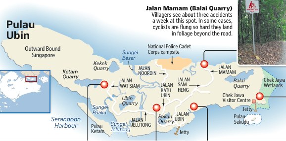
- Read about the Danger Spots in Ubin (ST, 30 Mar 2011):
(Ref: Safe Cycling in Ubin (2008))
IV – Learning more about Pulau Ubin
Links
- Friends of Ubin Network, formed in 2014, has a microsite
- Learn more about Ubin's heritage - see Pulau Ubin Stories (2004 - 2007)
- See WildSingapore’s page on Cycling in Pulau Ubin
- Google! E.g. see “The Complete Guide for Exploring Pulau Ubin, Singapore,” by Eva (2019) on Trevallog
Short videos about Pulau Ubin to enhance your trip!
Nature
- “Welcome to Pulau Ubin” (Hiking guide; NParks, 2016) [3:59]
- “Pulau Ubin – the last rural land left in Singapore,” feat Subaraj Rajathurai (The Telegraph 2014) [2:32]
- “Exploring Pulau Ubin’s ecology: More than just a place to escape to,” by Audrey Tan and Marl Cheong (The Straits Times, 2020) [7:15]
- “Life on Ubin,” feat Subaraj Rajathurai (Ethnographica, 2016) [23:29]
People
- “The Boatmen of Ubin,” (Today, 2018) [3:24]
- “Pulau Ubin’s ‘Ah Ma’,” (Today, 2015) [1:28]
- “The Pulau Ubin Crab Hunter,” feat Satay (Our Grandfather Story 2018) [3:18]
- “A Day In The Life Pulau Ubin’s Postman,” feat Harom Jomahat (The New Paper 2017) [3:37]
- “A Journey To Pulau Ubin, In Search Of A Lost Home,” feat Nor Syazwan Bin Abdul Majid (Our Grandfather Story, 2019) [3:20]
- “Living in Pulau Ubin till the end,” feat Mr Ahmad Bin Kassim (Today, 2015) [1:02]
- “Pulau Ubin ‘is the place that saved us’ – WWII survivor,” feat Ahmad Kassim (Today 2017) [2:06]
- “Singapore Islands returning home to Pulau Ubin – The Islands That Made Us,” feat Ah Liang (CNA 2019) [10:25]
- “Pulau Ubin Singapore” (Koh Yiwei 2013) [4:26]
- “The Boat Operators of Pulau Ubin.” Heritage in Episodes Season 2 (NHB Root.sg, 2013) [7:46]
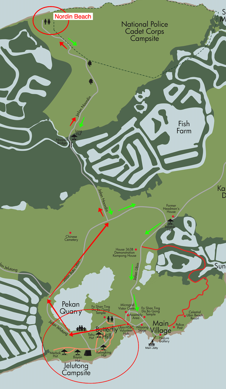
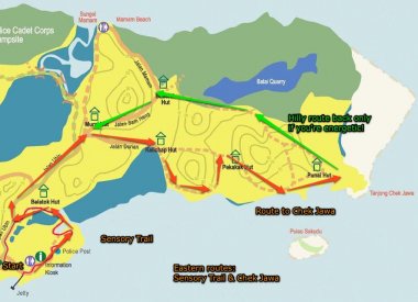
V – Possible Routes to explore on Pulau Ubin
By N. Sivasothi & Tan Kaixin (NUS Toddycats), ver 1.0 (23 Jul 2008)
The former basketball court, now sheltered, in front of the NParks Volunteer Hub
(Assembly Area on the map) is a good place to begin from. There is a panel map there.
1. Northern Routes (easy ride, 2-3 hours) Head left or right from the Village and heard north. Return the same way but take the other route to the village on the way back. 1a. Noordin Trail
1b. Maman Loop
| |
2. Western Ubin (longer routes to German Girl Shrine and former Thai temple; at least 3 hours)
| |
3. Eastern Ubin - has offroad and hilly parts (toughest routes, requires some skill; 3 hours) 3a. Sensory Trail Loop
3b. Chek Jawa Route (cont'd from 1a)
|
Cycling in Pulau Ubin, page of 8