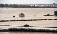
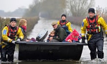
Large parts of England have endured the wettest January since records began, according to new figures released by the Met Office, as troops headed to the Somerset Levels to help deliver assistance to flood-hit communities.
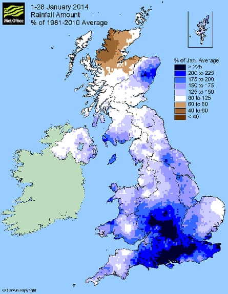
A large area from east Devon to Kent and inland across parts of the Midlands has already seen twice the average rainfall for the month.
Two days before the end of the month, the figures show that south-east and central southern England have already recorded twice their average rainfall – with 175.2mm between 1 and 28 January.
This beats the previous record of 158.2mm set in January 1988. And yet more rain is forecast, prompting the Environment Agency to issue 32 flood warnings, including 11 in the Midlands and 10 in the south-west.
Dr Liz Bentley, chief executive of the Royal Meteorological Society, said: "It looks quite close to breaking the January [rainfall] record and we've still got two days to go."
Interviewed on BBC Radio 4's Today programme, she warned that February also looked set to be wet. "There is no real sign of a dry spell to change the weather pattern," she said.
January's particularly heavy rainfall is unusual because the month is normally the coldest and windiest, but not the wettest. But with December also extremely wet in many parts of Britain, it fits an emerging pattern of extremes and unpredictable conditions.
Between April 2010 and March 2012, most of England and Wales were technically suffering drought conditions, receiving only 70-85% of average rainfall and needing hosepipe bans. Lowland southern England saw 60% or less of average rainfall for 12 of the 24 months.
But the drought came to an abrupt end in April 2012 and the next four months saw the heaviest rainfall in over 100 years across much of England and Wales.
The Met Office figures released on Thursday show that worst-hit areas from the recent floods in south-west England fell short of record-breaking levels of rainfall for January.
This area recorded 222.6mm between 1 and 28 January, making it the fifth wettest on record and the wettest since 1995, when 224.4mm fell.
The wettest January on record in this region was in 1948, when 244.3mm of rain was recorded.
A spokesman for the Met Office said the UK as a whole had seen a large amount of rain in January, but there have been significant regional differences.
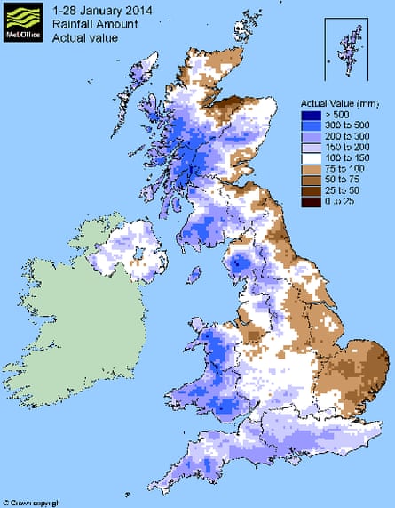
"For the UK as a whole, 164.6mm of rain has fallen so far this month, 35% above the long-term average, with all nations having above-average rainfall," he said.
"We have seen quite a contrast from south to north across the UK, with northern Scotland having received 85% of its long-term average rainfall so far this month, a sharp contrast to the 200% over southern England."
But the spokesman said the wet weather had been accompanied by milder temperatures.
The mean temperature across the UK up to 28 January was 4.9C, 1.2C above average.
"Looking at the winter season so far, the whole of the UK is on target for a wetter-than-average winter," he added.
"The main reason for the mild and wet weather so far is that we have seen a predominance of west and south-west winds, bringing in mild air from the Atlantic – as well as the unsettled and at times stormy conditions."
South-east and central southern England is already seeing its sixth wettest winter since 1910 and the wettest weather since 1995, when 369.7mm of rainfall was recorded.
The wettest winter on record was in 1915 with 437.1mm of rainfall.
Environment groups linked the succession of exceptionally wet or dry seasons to climate change. Dr Richard Dixon, director of Friends of the Earth Scotland, said, "November and December were record breakers in Scotland, with storm after storm hitting around Christmas. Climate change is bringing chaos to our weather, not just increasing global temperatures but affecting ocean currents and global air currents. Scotland is caught between the changing influences of disappearing Arctic ice, the shifting jet stream and a weakening Gulf Stream. It is no wonder our weather is becoming less and less predictable. The consequences for us are more extreme weather, including more flooding."

Comments (…)
Sign in or create your Guardian account to join the discussion